 |
 |
 |
|||||||
|
Mount St. Helens Washington USA
|
|||||||||
| MOUNT ST. HELENS COUNTRY, WASHINGTON: Published in 1981, this 17" x 24" sheet provides and "astronaut's view" of the volcano and area devastated by the eruption of May 18, 1980. The map margins include several paintings of the volcano, showing "before and after" views of the peak and Spirit Lake, and a text describes the geologic and eruptive history of the volcano and the details of the 1980 eruptions, along with the scientific studies being conducted on and around the mountain. The map provides a "Souvenir of an Eruption" and is a handy reference for those making the popular flights over the peak and auto trips around the area. | 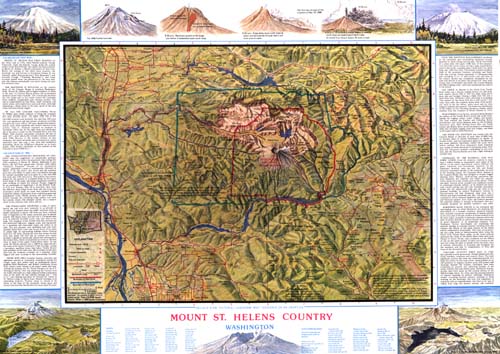 |
||||||||