 |
 |
 |
||||||||
|
Olympic Peninsula Washington USA
|
||||||||||
 |
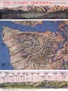 |
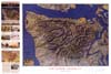
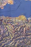
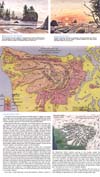
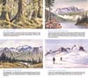
OLYMPIC PENINSULA, WASHINGTON: Published in 1974 and updated since, this 24" x 36" map sheet covers the Peninsula, the southern end of Vancouver Island, and the adjacent marine waterways, peninsulas and islands of the Puget Sound lowland. Included on the sheet's margin are several watercolors of selected views of the mountains, seashore, rain forest, and Hood Canal, along with a map and text describing the rock types forming the Peninsula and the extent of glacier cover during the Pleistocene ("Ice Ages") Epoch. | ||||||||
 |
||||||||||
 |
||||||||||
 |
||||||||||